
The use of drones in construction has ceased to be exotic. UAVs in construction today solve tasks that previously took days of work for an entire crew. Drone applications in construction cover quality control, precise geodetic surveying with drones, and material delivery to hard-to-reach areas of high-rises. According to industry research, time savings on site monitoring reach 30% compared to traditional methods. The UAV services market for the construction industry demonstrates steady growth of over 20% annually.
Construction companies implement construction automation with drones not for fashion. In practice, I often notice: one quadcopter replaces a team of surveyors for a week's work. And construction site monitoring becomes so accurate that clients see progress in real time without visiting the site. Drones for construction monitoring – it's like having a second foreman who works without days off and doesn't make subjective assessments.
Technological Capabilities of UAVs on Construction Sites

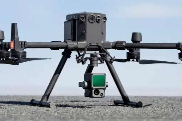
UAVs in construction – these aren't just flying cameras with propellers. Modern devices are equipped with laser scanners, thermal imagers, and GPS modules for drones with centimeter-level accuracy. Construction aerial photography allows creating point clouds of building sites that integrate with BIM technologies and drones directly. Laser scanning with drones provides detail unavailable to the human eye.
In one recent residential complex project, a drone with a 4K camera scanned a 5-hectare site in 25-30 minutes with standard image overlap. The result? A digital terrain model ready in 2 hours instead of 3 days of manual measurements. Topographic surveying with drones detects deviations up to 2 cm – critical for foundation pouring, where millimeters determine the fate of the structure. Drone surveying accuracy reaches the performance of industrial total stations, but 10 times faster.
It should be noted that the accuracy of modern RTK drones for construction reaches 1-2 cm horizontally and 3-5 cm vertically when using ground control points (GCP) and controlling shooting conditions. Without GCP, accuracy can decrease to 5-10 cm. This allows using them for as-built surveys, which was previously impossible without expensive geodetic equipment. Camera calibration and stable lighting are critical to achieving stated performance.
Types of unmanned aerial vehicles in construction differ by tasks and characteristics, like tools in a carpenter's box – each for its own purpose. The choice of a specific model depends on site specifics, territory area, and project priority tasks.
| Drone Type | Flight Time | Maneuverability | Best Application |
|---|---|---|---|
| Multicopters | 20-35 min | Excellent (hovering in place) | High-rise building inspection with drones, detailed construction site photography, facade monitoring |
| Fixed-wing type | 60-90 min | Low (requires runway) | Large territory construction site mapping, road construction, engineering surveys |
| Hybrid (VTOL) | 45-75 min | Medium | Engineering surveys with drones on linear objects (routes, power lines), geodetic work |
For most construction projects, multicopters are optimal thanks to the balance of maneuverability and flight time. Quadcopters in construction are used in 80% of cases – they're universal, like a Swiss knife. Key characteristics of professional models include payload up to 6 kg, flight time 25-45 minutes, and IP45 weather protection. Drones for geodetic work are additionally equipped with RTK and PPK modules for centimeter-level positioning accuracy.
Construction Quality Control with Drones: A Revolution in Supervision
Photography of construction sites with drones solves a problem every foreman has faced. How to verify whether the contractor actually completed 80% of earthworks? Previously, you had to take their word or spend a day on site visits with surveyors. Now unmanned construction site photography takes 20 minutes. Time is money, especially in construction.
The technology works simply. A drone flies around the area along a designated route, taking photos every 2 seconds. Software stitches them into an orthophotoplan of the construction area – an accurate map with coordinate reference. Then the system compares reality with the project and shows deviations in color: green – normal, yellow – minus 5%, red – critical. Construction quality control with drones occurs automatically, like autopilot in an airplane.
On one site last season, a UAV in an hour revealed that the excavation was dug 12% deeper than the project. This saved 80 cubic meters of soil removal – about $2400 in net savings. And most importantly, avoided overpayment to a dishonest contractor who tried to inflate work volumes.
Construction supervision with unmanned systems covers several work areas. Remote construction control is especially valuable for investors – instead of monthly site visits, they receive weekly 3D models of building structures with work progress. Automated site monitoring shows dynamics in numbers: how much material was delivered, what structures were installed, where equipment is idle. Construction progress monitoring transforms from an art into an exact science.
Inspection of construction sites in hard-to-reach zones – another significant advantage. Check the quality of welds at 40 meters height without scaffolding? A quadcopter with a thermal imager handles it in 10 minutes. Thermal imaging survey of construction facilities reveals hidden insulation defects at the installation stage – huge savings on rework. Inspection of a shopping center roof with an area of 15,000 m² previously required a week of industrial climber work. Now – 2 hours of flight and detailed images of each section with the ability to detect defects from 2-3 mm in size with standard photography. More details about monitoring methodology can be found in the research on construction site management using drones.
Cargo Delivery with Drones: Savings on Every Trip
 Material delivery to construction sites with unmanned vehicles sounds futuristic. But it works now in pilot mode, albeit with significant weight, range, and legislative regulation limitations. Cargo UAVs can transport up to 10 kg over a distance of up to 15 km per trip in ideal conditions. It's important to understand: in most jurisdictions (EU, USA, Ukraine) flights with cargo over people require special permits and increased liability insurance. This won't replace a dump truck, but solves specific tasks that previously paralyzed work.
Real application scenarios include several work areas. Urgent delivery of tools and fasteners to upper floors of high-rises saves 2-3 hours of elevator and loader waiting. Transportation of material samples to the laboratory reduces time from 4 hours to 40 minutes – analysis is ready the same day. Transfer of drawings, documentation, and measuring instruments to remote sections increases work efficiency and eliminates crew downtime.
In practice working with private clients, I encountered a case when they forgot a drill bit of the needed diameter for anchors in a monolithic wall. The nearest warehouse – 40 km away, road with traffic jams. A courier would drive 3 hours round trip. The drone delivered in 35 minutes – the crew didn't stand idle, the client was satisfied. Thus, even small delays result in significant losses on the project scale.
The cost of drone delivery is about $3.8 per 1 kg/km without subsidies. This is more expensive than a truck, but 5-7 times faster for urgent situations. For urgent cargo, downtime savings outweigh logistics costs – downtime of a 5-person crew costs $50-80 per hour.
Limitations are significant and require consideration when planning deliveries. Weather conditions block flights with wind over 12 m/s, rain or snow – high weather dependence. Cargo weight is limited – most models carry a maximum of 5-7 kg payload. Flight range depends on the battery and is 20-30 km round trip without recharging. Safety requires avoiding flights over people with cargo – strict regulations. It should be noted that construction automation with drones in logistics is still at the pilot project stage, but progress is obvious.
Integration of BIM Technologies and Drones: Digital Twin of Construction
Integration of BIM technologies and drones – this is a transition from simple monitoring to smart construction of the future. The Building Information Modeling system contains a digital twin of the building with all utilities, structures, and materials down to the last bolt. The unmanned vehicle photographs actual progress, and drone software automatically compares fact with plan, like an accountant reconciles the balance.
How does this work in practice? In the morning, a drone flies around the construction site and creates 3D models of building structures in high resolution. By lunchtime, data is processed and overlaid on the BIM model in a unified coordinate system. The system shows deviations: columns on axis B are installed with 3 cm deviation to the left, 4th floor slab is poured 92%, entrance group is 4 days behind schedule. The foreman sees this on a tablet and makes decisions by the end of the working day – maximum efficiency.
Photogrammetry in construction allows obtaining a cloud of millions of points, each with X, Y, Z coordinates with centimeter accuracy when properly configured. For complex terrain or objects with dense vegetation, laser scanning (LiDAR) works better, which penetrates through foliage and creates a more accurate surface model. Photogrammetry is optimal for visual inspection, creating textured models, and working on open sites with good lighting. Drone data processing in programs like Pix4D or DroneDeploy turns these points into a model that can be rotated, sectioned, measured like a real object. Volume of excavated pit, area of installed formwork, amount of laid asphalt – everything is calculated automatically without a tape measure. A detailed guide on integrating scanning data with BIM is presented in the comprehensive Scan to BIM guide.
Digitalization of construction through drones reduces report preparation time by 60-70% without quality loss according to pilot project data from major construction companies. Instead of a week of manual data collection – one day of photography and processing in specialized software. And volume calculation accuracy increases to 92-95% when using photogrammetry or up to 97-98% with LiDAR laser scanning, which is critical for work acceptance.
Automatic inspections reveal defects that are not visible from the ground with the naked eye. Thermal imaging shows heat leaks through poor insulation, uneven concrete heating during winter concreting, hidden cavities in structures before their critical growth. This isn't just control – it's defect prevention before it becomes an expensive problem. Material counting is also automated – the system counts brick stacks by photo, bulk soil volumes by terrain, roofing area by geometry with ±3-5% accuracy. It's known that the human factor in calculations gives an error of up to 15-20%.
Economics of Construction Drone Implementation: Real ROI Figures
 The numbers speak for themselves without embellishment. Monitoring time is reduced from 3-5 days to 4-6 hours according to real site implementation data – saving 85-90% of specialist working time. Cost of topographic survey of 10 hectares drops from $8,000-12,000 to $1,500-2,500 for equivalent work by contractor estimates. Reduction in quality control costs reaches 40-50% through early defect detection and prevention of rework in a typical project.
In practice working with private clients, this situation occurs regularly. A developer hires a technical supervision engineer for $4,000 per month for quality control. He arrives once a week, spends 4 hours on site visits, takes ground-level photos and writes a report on the fly. Per month – 4 visits, 16 hours of work, minimal details. Alternative: construction drones priced from $2,000 for a basic model, plus a part-time operator for $1,200. Total: $3,200 per month, but 10 times more data and higher accuracy. Payback – in 2 months of operation.
Construction site safety – this is also savings in monetary terms. One accident costs the company $50,000-200,000 including fines, downtime, and reputational losses in future tenders. Construction drones minimize risks dramatically: no need to send people to height for facade inspections, can check emergency structures without approaching them closely, easily detect safety violations before incidents in real time.
Let's consider specific savings indicators for various tasks compared to traditional work methods.
| Task | Traditional Method | Using Drones | Savings |
|---|---|---|---|
| Topographic survey 5 ha | $6,000, 5 days | $1,800, 1 day | 70% cost, 80% time |
| Roof inspection 10,000 m² | $3,500, 3 days | $800, 4 hours | 77% cost, 95% time |
| Work progress monitoring | $2,000/month | $600/month | 70% monthly expenses |
| Earthwork volume calculation | $1,500, 2 days | $400, 3 hours | 73% cost, 90% time |
| 15-story facade survey | $5,000, 7 days | $1,200, 1 day | 76% cost, 85% time |
Data shows average savings of 70-75% on work cost and 80-90% on completion time with comparable or higher result quality. These aren't theoretical calculations, but real implementation practice on hundreds of sites.
Savings on work cost and completion time according to construction site implementation data – this isn't marketing exaggeration. Companies with regular geodesy and monitoring needs recover investments in 3-6 months of active work. If your project shows less than 50% savings – reconsider the implementation strategy or change the contractor.
Implementation Budgets: From Small Business to Corporations
The selection strategy depends on operation scale and frequency of drone use for construction site monitoring. Let's consider real payback calculations for different business scenarios with specific figures.
| Business Scale | Solution | Year 1 Investment | Payback |
|---|---|---|---|
| Small (1-3 sites/year) | Order construction site aerial photography from contractor | $6,000-9,000 | Current expenses (no equipment investment) |
| Medium (5-10 sites) | Construction drone rental + drone operator training | $9,000-12,000 | 4-6 months |
| Large (15+ sites) | Buy construction drone + staff operator | $25,000-35,000 | 2-3 months |
| Corporate (50+ sites) | Drone fleet + monitoring department with certified specialists | $80,000-120,000 | 3-6 months |
Critical point – consider hidden expenses often forgotten in initial calculations: insurance ($500-1,500/year mandatory), spare batteries ($150-300 each, need minimum 3-4 for continuous work), propeller repair ($50-200/year depending on intensity), and drone software updates (may grow by 20% in 2 years due to subscription inflation). These costs add 15-20% to the base cost of ownership – calculate in advance.
Limitations and Challenges in UAV Implementation
 The application of drones in construction – this isn't a magic "solve all problems" button. There are real obstacles you need to know before starting implementation to avoid disappointments and unnecessary spending.
Legislative barriers are at the top of the problem list. In most countries, registration of UAVs weighing from 250 g and above is required. The European Union applies the EASA regulatory framework with Open categories (for light operations) and Specific (for complex scenarios with risk assessment). In the USA, FAA Part 107 rules apply: maximum flight altitude 400 feet (122 m), mandatory visual contact with the drone, possibility of obtaining special permits (waivers) for exceptions. In Ukraine, permitting procedures are regulated by the State Aviation Service of Ukraine. Flights over people without their consent are categorically prohibited in most jurisdictions. Photography near critical infrastructure (airports, military facilities, power plants) requires separate permits from authorized aviation and security authorities of the respective country. The permit process takes from 2 weeks to 2 months depending on region and operation complexity.
Technical limitations are no less important for work planning. Modern model flight time – 20-35 minutes in ideal conditions, this is enough to photograph 3-5 hectares per flight without recharging. For large sites, 3-4 batteries and changes every half hour are needed – plan logistics. Weather critically affects operations: rain, snow, fog completely block flights, wind over 10-12 m/s makes photography poor quality with blurred frames. In winter, battery capacity drops by 30-40% – working day is reduced by half.
In practice, I often notice: companies buy a drone for $8,000, but don't account for the need for spare batteries at $200, charging stations at $150, protective cases at $300. The real cost of a working kit is 1.5-2 times higher than the base model price – calculate the complete set immediately.
Cybersecurity – a growing threat in the digitalization era. Unmanned aerial vehicles in construction collect sensitive project data: site plans, work volumes, completion deadlines, technological solutions – commercial secrets. Cloud storage hacking or data transmission interception can give competitors information worth millions. Professional models use data encryption, but properly configuring protection is critical: use encrypted data transmission channels (TLS 1.3+), Zero-Trust model for cloud storage access (role-based authorization), regular password rotation (every 90 days minimum), and data storage policy with access audit (retention ≥ 12 months with logging of all operations). Not all companies configure this correctly the first time – involve IT specialists in system setup.
Cost – another factor for financial planning. A professional drone with RTK costs $5,000-15,000 depending on functionality, processing software – $1,500-5,000 per year by subscription without one-time purchase option, operator training – $800-2,000 for a complete course, insurance – $500-1,500 per year depending on coverage limits. Initial investment for a medium project – about $10,000-25,000 excluding unforeseen expenses. For a large company, this pays back in 3-6 months of active work, for a small one – can be a critical budget hit.
When Drones Aren't Optimal: An Honest Look at Alternatives
An honest professional answer: quadcopters in construction aren't suitable for every project and every task. In some scenarios, traditional methods are more efficient and cheaper long-term.
Sites less than 0.5 hectares don't require aerial photography from the air. A private house or small cottage can be quality photographed from the ground or a stepladder in 30 minutes. A UAV will only pay off with regular work on dozens of such sites – individual cases don't justify the costs.
One-time photography need makes equipment purchase impractical from an accounting perspective. If you need topographic survey once every 2-3 years for reporting – hire a contractor for $800-1,200 turnkey. Buying a drone for $8,000 is economically unjustified – money will be "dead" weight. The break-even point starts from 8-10 surveys per year minimum.
Extreme weather conditions seriously limit equipment use in reality. Regions with constant strong winds (over 15 m/s most of the year), frequent precipitation, or extreme temperatures make flights impossible more than half the year without exceptions. If 6+ months weather is unfavorable – efficiency drops by 50% or more, payback stretches to years.
Typical Implementation Mistakes: Learning from Others' Problems
Analysis of real projects shows disappointing statistics: 40% of companies make the same mistakes during first implementation. Study them in advance to save money, time, and nerves – yours and colleagues'.
Mistake #1: Buying a drone without a clear use purpose
A company buys an expensive drone for $15,000 because competitors use and boast about results. Reality after six months: the device sits in the office 8 months out of 12 in a box because it's unclear how to apply it systematically in current processes. Simple solution: first determine 2-3 specific tasks (weekly construction progress monitoring, geodetic surveying with drones before starting work, monthly facade inspection), then choose a model for them with needed functionality.
Mistake #2: Ignoring personnel training
Bought a professional drone with GPS modules for drones, but didn't train the operator in basic piloting skills – the result is predictable: poor quality photography with missed territory sections, data unsuitable for designers' work. Re-shooting costs the same as the first attempt – double expenses. Solution: allocate $1,500-2,000 and 4 weeks for pilot certification with practical classes or hire a contractor with experience on similar sites.
Mistake #3: Underestimating software cost
Basic drone costs $8,000 one-time, but professional software subscription for data processing and model creation – $4,500/year annually without opt-out option. In 3 years, drone software will cost more than the device itself – a surprise for accounting. Proven solution in practice: consider total cost of ownership (TCO) for 3 years of work, not just the initial purchase in the first quarter.
Thus, implementation should be viewed as a systemic project with stages, not as buying another office gadget. Process planning, people training, and integration into workflows are more important than the hardware itself – equipment is secondary.
Real Case: How Drones Changed a $500 Million Project
In 2023, Turner Construction applied UAVs in construction of a commercial complex in Chicago with a half-billion dollar budget. Drones with high-resolution cameras and optional LiDAR scanners flew around the site daily on schedule, creating 3D models of building structures and integrating data with BIM in real time. This allowed tracking progress with 95% accuracy daily, identifying discrepancies between design and reality at early stages, and fully automating routine inspections. Results exceeded expectations: survey time reduced by 30%, inspections – by 60%, which saved about $5 million net on preventing rework and shortening deadlines. Safety increased dramatically – personnel don't climb scaffolding to height, and investors received VR visualization of work progress from the office. This case inspired a significant portion of American construction firms to implement drones, showing real ROI in the first year of operation.
Future of Unmanned Systems in the Construction Industry
 Analyst forecasts show impressive growth dynamics of the industry unmanned systems services market for construction in coming years. Growth drivers are clearly defined: artificial intelligence and machine learning (automatic defect detection without human participation in the process), autonomous drone fleets (one operator manages 5-10 UAVs simultaneously from a center), drone integration with management systems and IoT (UAVs interact with site sensors automatically), development of 5G networks (4K video transmission in real time without delays and quality loss).
AI analytics is already radically changing the work process. Neural networks are trained to recognize typical defects on hundreds of thousands of images: concrete cracks from 0.5 mm wide, reinforcement corrosion at early stages, incorrect structure installation with deviations. The drone photographs the site, the system analyzes and marks problem zones automatically with red markers. Recognition accuracy reaches 90-92% – comparable to an experienced inspector with 20 years of experience.
It should be noted that autonomous UAV swarms – this is no longer science fiction from Hollywood films. Companies are developing control systems where 3-5 UAVs fly around construction along coordinated routes without intersections, avoiding collisions with each other and automatically eliminating shooting zone duplication. One operator launches the mission in the morning, drones execute it independently until lunch, data is collected into a unified model by evening. Productivity grows 4-5 times compared to manual control – the revolution is obvious.
Integration with BIM technologies and drones reaches a qualitatively new automation level. Cloud drone platforms are emerging where the building's digital twin updates automatically after each flyover without human participation. Artificial intelligence compares plan and fact in background mode, predicts schedule disruption 2-3 weeks before a critical problem with 85% probability, suggests optimization of equipment placement on site based on statistics. Construction site mapping becomes a continuous process, not a one-time event once a month.
Small and medium businesses gain access to technologies through cloud subscription services. No need to buy a drone for $15,000 and maintain an operator on staff – you can rent a turnkey service: a specialist with equipment arrives once a week on schedule, photographs the site in 2 hours, data is uploaded to cloud drone platforms automatically. Drone photography cost under this model – $500-800 per month instead of $10,000 initial hardware investment. Entry threshold drops every year, accessibility grows for all market segments.
Practical Guide: Step-by-Step Implementation Plan
Implementing quadcopters in construction requires a systematic approach with a clear plan. You need to start with an honest needs assessment and selection of priority tasks for the first stage.
Step one – define goals with specific metrics. What's more critical for your business: progress control for clients once a week, geodetic surveying with drones for designing new sites, inspection of hard-to-reach zones for safety, marketing content for apartment sales? This directly determines equipment and software choice – don't spread goals thin.
Step two – choose a drone for tasks with functionality margin. For basic construction progress monitoring, professional-class models ($5,000-7,000) with 20 MP camera and 40-minute flight time without wind are suitable. For precise geodesy, devices with RTK module ($6,000-8,000) with coordinate correction and centimeter accuracy are needed. For inspections in complex high-rise conditions – industrial models ($10,000-14,000) with IP45 weather protection and ability to install thermal imager or laser scanner. Popular manufacturers include DJI, Autel Robotics, Skydio, and Parrot for various price segments.
In one recent project, a company saved $4,000 net by renting a drone for a month for testing instead of buying immediately. This allowed testing the technology without large investments in the unknown and making an informed purchase decision based on real numbers.
Step three – choose software for data format. DroneDeploy ($4,200/year subscription) is good for construction site mapping and creating orthophotoplans quickly. Pix4D ($4,200/year) is better for photogrammetry in construction and deep integration with BIM systems. Autodesk BIM 360 allows uploading models directly to project documentation without conversion. There are free options like WebODM for initial experiments with 60% functionality of paid versions.
Step four – train personnel or hire an experienced operator. Pilot certification takes 3-4 weeks of training and costs $800-1,500 for a complete course with exam. Alternative for quick start – hire a contractor who will provide turnkey drone services for construction with equipment. Professional photography cost – $500-1,200 per visit depending on site area and terrain complexity.
Step five – start with a pilot project on one site. Choose a medium-complexity site, conduct photography once a week for a month on a clear schedule. Evaluate three parameters: data quality (do they meet designers' requirements), work convenience (how much time the team saves), client reaction (is he satisfied with progress visualization). Only after a successful pilot scale to all company projects – this minimizes failure risks and works out processes in practice without stress.
Little-Known Facts About Drone Applications for Geodetic Work
High-altitude mapping without risk to people – a fact few know outside the industry. Construction UAVs create 3D terrain models with centimeter accuracy in an hour, allowing engineers to accurately assess earthworks and control excavation quality, minimizing errors by 20-30% compared to manual methods. Little known to the general public that such models integrate with BIM for automatic detection of concrete defects at early hardening stages.
Automatic structure inspection and construction site safety – another recent discovery. UAVs are equipped with thermal imagers for detecting hidden cracks from 0.3 mm wide or overheating in structures at depths up to 5 cm, reducing the need for dangerous manual height checks by half. Interesting fact from practice: they prevent up to 40% of site incidents annually, scanning zones inaccessible to humans without special equipment – roofs, facades, upper tiers.
Material delivery to hard-to-reach high-rise zones – little-known application of cargo models. Cargo drone trucks with payload up to 10 kg deliver tools or concrete samples to upper floors of skyscrapers in 15 minutes, reducing logistics by 50% in time. In future automated systems, they will coordinate routes with ground robots for optimal "last mile" delivery.
Environmental bonus of use – drones reduce construction carbon footprint by 15-20% per project, replacing trucks for small documentation deliveries and minimizing fuel costs on remote section inspections. Little known: they're used to monitor soil erosion on large site construction, preventing environmental fines from government authorities up to $50,000 for violating environmental legislation.
Drones on hydrogen fuel cells – a promising technology with flight time up to 2 hours continuously (vs 30 minutes on traditional model lithium batteries). Doosan Mobility Innovation already produces serial models for industrial application in Asia. Cost is 3-4 times higher than basic versions, but productivity – 3 times more per working day, payback in a year of intensive operation.
Conclusions: Is It Worth Implementing Drones Right Now
 The application of drones in construction has transitioned from the category of enthusiast experiments to standard practice of serious companies. Numbers are convincing without embellishment: savings on geodesy are real, monitoring time reduction is verified, investment payback in 3-6 months is documented by hundreds of cases. Quadcopters in construction – this isn't replacing qualified people, but enhancing their capabilities and doubling labor productivity.
Key conclusions for making an informed decision follow from practice. Start with a small budget – rent a service or equipment for 1-2 months for real testing on your sites. Focus on specific tasks with measurable metrics: if progress control is critical – invest in weekly monitoring, if precise geodesy is important – get RTK models and professional software. Train your people or find a reliable contractor with a portfolio – work quality depends on operator qualification by at least 80%.
Ready to take the first step toward automation? Determine one key task at your site right now (construction progress monitoring, topographic geodesy, or facade inspection). Request a trial shoot from several contractors with portfolios or rent a drone for a month for testing. Evaluate results by specific metrics in numbers: time savings, data accuracy, client reaction to visualization. Only after this make an informed decision about purchasing equipment for ownership.
Real barriers exist – legislation is complex, weather is unpredictable, equipment cost is high for startups. But they're solvable with the right planning approach. The market is growing steadily, technologies are getting cheaper annually, and capabilities expand with each firmware update. Construction automation with drones – this is an investment not in fashionable equipment for display, but in real work speed, data accuracy, and people's safety at height. Projects are completed on time without rushes, clients are satisfied with process transparency, workers don't risk their lives on 15th floor scaffolding. And you get specific numbers in reports instead of subjective "approximately 70% complete" assessments from the foreman.